
LiDAR Data Processing
Flairtek LiDAR Data Processing transforms raw 3D point cloud data into actionable insights for industries like surveying, urban planning, environmental monitoring, and infrastructure management. Our services include point cloud processing, 3D modeling, feature extraction, DEM/DTM generation, and GIS integration, delivering accurate, high-quality, and ready-to-use spatial data for informed decision-making.
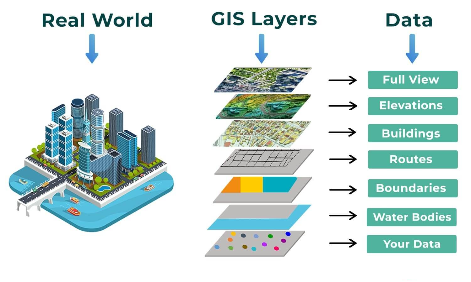
MAPPING & GIS SERVICES
Flairtek Mapping & GIS Services provides accurate, actionable geospatial solutions for businesses and organizations. Our services include spatial data collection, GIS mapping, remote sensing, 3D visualization, and asset management, enabling you to analyze, interpret, and visualize geographic data for smarter planning, resource management, and informed decision-making.