Mapping & GIS Services
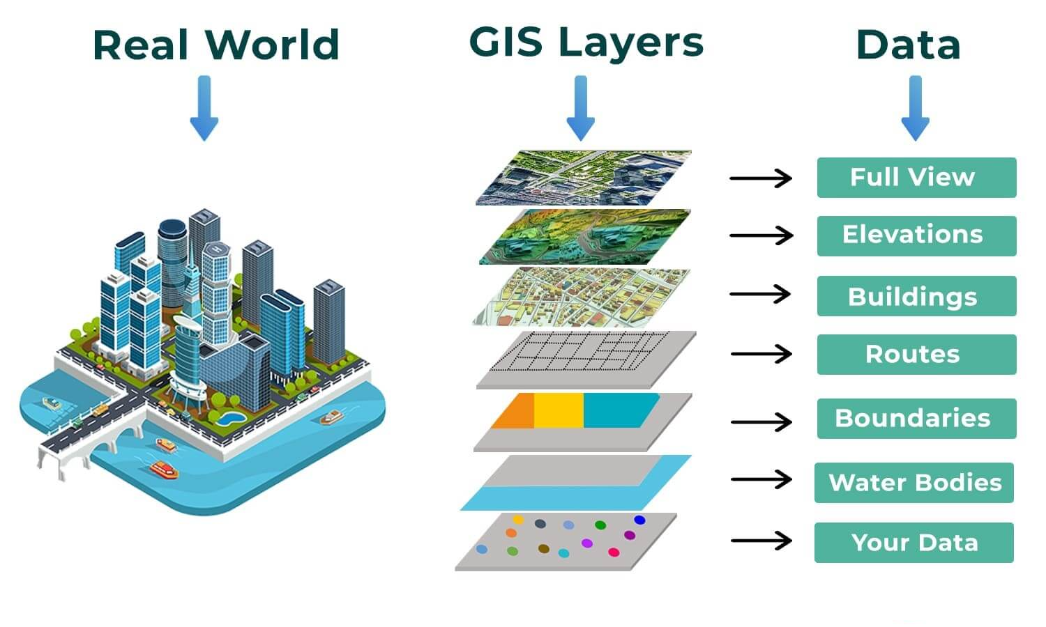
At Flairtek, we provide comprehensive Mapping and GIS (Geographic Information System) services that enable organizations to visualize, analyze, and interpret spatial data for smarter decision-making. Our solutions combine cutting-edge technology with expert geospatial knowledge to deliver accurate, actionable insights for a wide range of industries.
Whether for urban planning, infrastructure management, environmental monitoring, or resource management, our GIS services transform complex geographic data into clear, interactive, and meaningful maps.
Our Mapping & GIS Services
Flairtek offers end-to-end GIS solutions, including:
-
Spatial Data Collection & Management – Capturing, storing, and maintaining high-quality spatial datasets from multiple sources including surveys, satellite imagery, and LiDAR data.
-
GIS Mapping & Visualization – Creating interactive maps, dashboards, and 3D visualizations for better understanding of geospatial data.
-
Remote Sensing & Satellite Data Analysis – Leveraging satellite imagery and aerial data for land-use planning, environmental monitoring, and disaster management.
-
Geospatial Data Analysis & Modeling – Performing spatial analysis, predictive modeling, and scenario planning for informed decision-making.
-
Topographic & Thematic Mapping – Producing detailed topographic maps and specialized thematic maps for specific industries.
-
GIS Integration & Web Mapping – Integrating GIS solutions into enterprise systems or web platforms for real-time access and interactive spatial tools.
-
Asset & Infrastructure Management – Mapping and managing infrastructure, utilities, and critical assets efficiently using GIS tools.
Why GIS & Mapping Services Matter
Effective GIS and mapping solutions allow organizations to:
-
Gain insightful spatial intelligence for better decision-making
-
Monitor environmental changes and urban development
-
Optimize resource allocation and infrastructure planning
-
Improve risk management and disaster preparedness
-
Visualize complex data in an interactive and easy-to-understand way
Why Choose Flairtek for Mapping & GIS Services?
-
🌐 Expert geospatial team with extensive experience
-
⚙️ Advanced GIS and mapping technologies for high-precision outputs
-
🗺️ Customized solutions tailored to your business or project needs
-
🚀 Accurate, scalable, and actionable geospatial data
-
💻 Integration with GIS, CAD, and other enterprise systems
-
🤝 End-to-end support from data collection to analysis and reporting
🌐 Expert geospatial team with extensive experience
⚙️ Advanced GIS and mapping technologies for high-precision outputs
🗺️ Customized solutions tailored to your business or project needs
🚀 Accurate, scalable, and actionable geospatial data
💻 Integration with GIS, CAD, and other enterprise systems
🤝 End-to-end support from data collection to analysis and reporting
At Flairtek, we don’t just create maps — we provide geospatial intelligence that drives smarter decisions, enhances operational efficiency, and supports sustainable development.